


You are using an out of date browser. It may not display this or other websites correctly.
You should upgrade or use an alternative browser.
You should upgrade or use an alternative browser.
West Virginia run
- Thread starter acto
- Start date
Carmen
Well-known member
I've been to WV twice this summer but haven't begun to tap into the endless array of roads the state has to offer. Having said that, I can suggest some must see routes that are sure to please you.
-220 South from Cumberland Maryland to Franklin WV (beautiful mountainous twisties the whole way)
-33 West to 28 north (this takes you through Germany Valley)
- Off 28 is a 10 mile twisty road climbing Spruce Knob(WV's highest mountain at over 4800 ft.)
-On 28 also is Seneca Rocks
-Take 33 west at Seneca Rocks to Elkins WV
-From there you can continue to circle other mountainous roads in the park
The mountain range runs north to south, so most roads in the Monongahela National Park running east/west can't help but be entertaining.
Others will suggest more roads I'm sure.
Btw, watch out for deer. It is the worst place I've ever ridden for deer encounters (even in the middle of the day).
It would seem logical to check the forecast first, I'd think. Forecast down there (and along the way) seems to be for rain for the days indicated. If I were touring by bike, I'd reconsider given the rain. This time of year, if you're wet, you'll be very cold and your belongings/spare clothes will probably get wet as well.
wonderings
Well-known member
It would seem logical to check the forecast first, I'd think. Forecast down there (and along the way) seems to be for rain for the days indicated. If I were touring by bike, I'd reconsider given the rain. This time of year, if you're wet, you'll be very cold and your belongings/spare clothes will probably get wet as well.
If you waited only for perfect weather, people just wouldn't go anywhere.
Dress properly, have the right gear and enjoy it, rain or shine.
If you waited only for perfect weather, people just wouldn't go anywhere.
Dress properly, have the right gear and enjoy it, rain or shine.
You're right, dealing with weather is part of the shtick when you ride long distances for multiple days. When I travel I like to do a bit of photography and stuff or maybe a small hike to a scenic viewpoint and you really aren't going to have the opportunity to do these things which I consider a key part to the enjoyment of it.
Beyond that, you'll be pressing on for long stretches wet and cold which can take some of your concentration away from the task at hand, leading to potential issues there as well.
All I was suggesting is it wouldn't be something I would do this wknd if it were me, as this is still early fall and there are still several wknds (including Thanksgiving long wknd) to come when weather may likely be better.
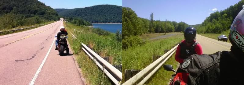
Couple shoots from 250.
http://www.gtamotorcycle.com/vbforum/showthread.php?146642-West-Virginia-and-Virginia-Roads
http://www.gtamotorcycle.com/vbforum/showthread.php?146642-West-Virginia-and-Virginia-Roads
BeastieGirl
Well-known member
Hey tnx for the responses and the routes. We got back last night. We had an amazing time on some incredible road. That 250 is something else. One of the best things was the lack of traffic. We were alone 85% of the time. Tnx again and I can't wait to go back.
A
It is addictive - twisty, good pavement little traffic - ggod sitelines. 250 is mostly marked at 55 mph and curves that would be posted at 40 kph here seem to warrant a 35 mph there - guess they figure in WV if they posted all the winding roads at a snail's pace nobody would ever get anywhere.
Last edited:
BeastieGirl
Well-known member
OK - that's it - I gotta do one more run this year. Also gotta stop watching this at work, my boss is wondering why I keep leaning side to side in my chair
")
mototrek
Well-known member
.... my boss is wondering why I keep leaning side to side in my chair
Blame it on gas.
If you have the time, take 144 and 26 all the way down to Cumberland area. You won't be disappointed.
What route do you guys take down?
acto
Well-known member
We took 219 all the way down back in July. We stayed at snowshoe mountain WV. It is a pretty nice ride down, with only a couple stints on the freeways. The roads there are incredible! Have fun.
We trailered our bikes down and also stayed at snowshoe mountain resort. We go a great off season rate. We had a blast.
Carmen
Well-known member
I was checking out Google Maps (set to satellite view as I often do) and I noticed a couple of roads that look gorgeous going through high elevations and following a serpentine river for many miles. I'm talking about 32 north of Harmon WV (off 33) connecting with 72 which continues in a north west direction and eventually rejoins 219 at Parsons WV. Any one ever done it? I'm going to have to check it out next year.
Are you talking about this section? I made a mistake going in there after riding the section North of 219. We almost had to walk the bike through there!! The surface was very rough (compact gravel on some parts) as it apporaches 32, it gets better. It was an experience though. That was two years ago around this time of the year and I don't know how it is now. You may want to give it a try. We went from 50 all the way to 32 through 72.
http://maps.google.ca/maps?saddr=US...w&vpsrc=0&mra=dpe&mrsp=1&sz=12&via=1&t=m&z=12
If you have the courage to go fast, try this part, you will love it.
http://maps.google.ca/maps?saddr=US...dpAtB-w&vpsrc=0&mra=dme&mrsp=0&sz=14&t=m&z=14
http://maps.google.ca/maps?saddr=US...w&vpsrc=0&mra=dpe&mrsp=1&sz=12&via=1&t=m&z=12
If you have the courage to go fast, try this part, you will love it.
http://maps.google.ca/maps?saddr=US...dpAtB-w&vpsrc=0&mra=dme&mrsp=0&sz=14&t=m&z=14
I was checking out Google Maps (set to satellite view as I often do) and I noticed a couple of roads that look gorgeous going through high elevations and following a serpentine river for many miles. I'm talking about 32 north of Harmon WV (off 33) connecting with 72 which continues in a north west direction and eventually rejoins 219 at Parsons WV. Any one ever done it? I'm going to have to check it out next year.