Motorcycle Navigation | GTAMotorcycle.com

Motorcycle Navigation

SeeThruHead

Member
So I'm planning to do some longer trips on a new bike in the upcoming season. Lot's of road and offroad miles is likely.
I want to work my up to doing something majorly offroad like the "Great Continental Divide Ride" within the next 2 years.

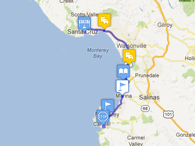
Currently looking into trip planning and navigation research.
I've watched
in the video he's using maps.me app as well as the Garmin Montana.

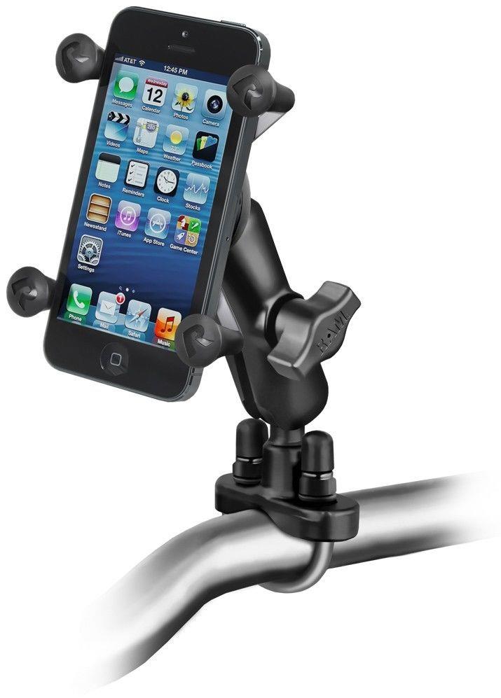
When I'm doing research I keep coming across the Garmin Zumo motorcycle specific gps and it's features like routing that prefers/avoids curvy roads, hills, etc.

Then there is another group of people who pair their ipad to a Garmin inreach (which is good to have in case of emergencies anyway) and use apps like Gaia GPS
While gaia gps really does look like a better overall planning and gps tool than the Garmin. it's missing any motorcycle specific routing features.

I would love to hear if anyone has any experience with any of this gear/apps I've mentioned, or just generally what people are using for navigation on long tours, both on and off road.
 
For off road navigation the Garmin Montana is better than the Zumo.
What you really want for off road is the ability to load tracks, which in essence are a line shown on your GPS and don't need to follow roads.
That is what Kevin and other off-road/adventure resources (such as Backcountry Discovery Routes (BDR) ) will provide, a GPX file which has the tracks.
It takes some manipulations for them to work on a Zumo, as the GPS wil try to re-route you onto known roads whereas with a Montana they will show up on your GPS and you just follow the line.
Note that you can't get turn-by-turn navigation with tracks, but I haven't found that to be an issue.
The Montana can also do turn-by-turn navigation just like a Zumo if you just tell it where you want to go and have the GPS guide you there.
I started with a Zumo and went to the Montana for that reason.
Thank you! That's very interesting to hear. So either way a montano or gaia (both have great track capability so i've heard) would be better for those kinds of trips. I still wouldn't mind getting some automated help to find nice twisty roads though. But not enough to justify having both.

though
seems to suggest that zumo's can handle tracks
also track support is in the manual for the zumo devices as well?
did you have the current zumo models?
or was track functionality just not as good in some way?
 
Last edited:
seems to suggest that zumo's can handle tracks
also track support is in the manual for the zumo devices as well?
did you have the current zumo models?
or was track functionality just not as good in some way?

I had a Zumo 660 and yes, they can handle tracks, but just not as easily and efficiently as a Montana.
Keep in mind that I am referring to off road navigation, so there will be no roads showing on your GPS and for your GPS to navigate you onto.
With the Zumo I had to turn off automatic navigation and put it into off road mode
With the Montana, I just load the tracks from Basecamp and then in the GPS pick a color and set it to 'Show on map'.
Then I just display the map and follow the line showing.
Ah I see!
The new zumo's all have the same thing the montana has then.You can show any track on the map as a line in any color. Looks like they are closer now to the montana than they were with the 660.

Thanks!
 
google maps to rough out the route for planning days/overnight points
then final plotting and way points go into Tyre
then that is uploaded to a TomTom Rider GPS

the Rider has some motorcycle specific featurers
thrill route, avoid toll roads, avoid dirt roads etc

I like the thrill route option if I'm not in a hurry
takes to you to your preset way point
but selects twisty roads
 
I use Maps.ME quite a bit on my mobile when I am out of my Cell service area, which is easy to do with Freedom. Very helpful I always going off my intended route. Nothing off road mind you. Sometimes the app doesn't always sense the correct direction you are facing though. I also wish the maps could be more visually simplified like Google, as MapME has extra visual info, which is helpful, but also distracting when you are just looking for road routes. Google maps also has a offline mode but is temporary and kinda a pain to select the area you want to download.
 
Furkot is excellent for trip planning.


The interface a bit of a challenge but worth even for the trips it references.
 
I just signed up for REVER.co and tried to plan a trip using Butler maps. Little did I know there are basically no butler maps for Canada. So I'll be getting a refund most likely. Though the application is actually quite nice.
 
I have a Garmin Zumo 396 and probably only utilize 25% of it's capability/features...
That said, I'm just as enamored with the GPS as a gadget as most people are. Reading the reams of threads on all the bike forums about GPS/Nav. it would appear we've become very dependent on the tech.
My first long bike trip was Burlington to Ft. Lauderdale Florida in 1992.
No GPS... 'Made it there and back by following the signs and using one of these>>
ksnY6mJ.png


I do love my GPS, but... what would we be doing if we didn't have 'em..?
 
Well we didn't have GPS for 45 of my 55 years riding so I guess we'd be fine. I'd miss the talking books tho :)

Downside with map ...you need to know where you are first. :coffee:
 
following signs is fine if you're staying on freeways
I guess that's a good plan for Goldwing dudes

those of us that like some twisty/scenic secondary highways, nah
too much uncertainty about where you are and stopping to look at maps

tried the phone in a holder thing, no bueno
I'm very happy with my TomTom Rider
 
those of us that like some twisty/scenic secondary highways, nah
too much uncertainty about where you are and stopping to look at maps

As long as you know which direction the sun came up from.... you should be fine.

GPS isnt 100% accurate as we call know...
I recall riding out west last year comforted in the knowledge that a gas station was up ahead... according to my GPS...
Got to the waypoint only to find the spot where a gas station "used to be"...Lol
 
IMO, the actual GPS unit is not as important as the maps you load onto it.

It really depends on who compiled the data that's being used to create the maps.

Some for-fee manufacturer-supplied maps have remarkably out-of-date data. Roads, restaurants and gas stations that are no longer there, or incorrectly marked.

Then there are free open-source maps with data that was contributed by people who actually live in some of these remote areas. As roads and other waypoints change, the data gets updated on a daily basis.

These days, I exclusively use maps compiled from OSM (Open Street Maps). Free and better than the manufacturer-supplied maps.

 
Googlemaps seems to keep reasonably up to date and with being able to download a large region it's a good reference.
Nice thing with a phone is you can use a variety of apps. We were in the Pyrenees, the GPS got very confused with the tight turns and switch backs. Useful to have a choice of sources.
Best aspect of the phone nav is sub routines like Winding Roads on TomTom app that lets you set a destination and let the app determine optional routes with more variety yet still moving in the direction you set.

As long as you know which direction the sun came up from.... you should be fine.

tricky at noon..I suppose you could hop off and look at the moss ;)
 
There are many drawbacks of using your phone as a GPS as opposed to a dedicated GPS unit:

- not vibration-resistant or water-proof. You'll need to spend a lot of money to buy special mounts and housing to keep it safe from the elements.
- I keep a lot of important stuff on the phone, and if I'm out in the sticks, I want to be sure that it'll be operational when I need it. The safest place it could be is either tucked in my jacket, or in protected luggage/tankbag on the bike, not mounted right up on the handlebar where it's out in the elements or exposed to falls or drops
- the capacitive screen only works with an ungloved finger. Pressure-sensitive GPS units can be operated by gloved hands while on the fly, you don't have to stop take off the glove to input or change a route.

I think using your phone as a GPS works for a segment of riders who don't want to spend a lot of money on a dedicated unit, don't ride off-road, don't ride in the rain, and don't need to fiddle with the screen while on-the-road.

It's an option.

Just not for me.
 
Totally agree. Using your phone is an expensive cheap option. What!
 
the sun thing works on short trips I guess
wouldn't be much use on a long day trying avoid highways

heading south I usually start to plot a route starting in upstate NY
and make down into VA - first day run
81 all the way is of course a piece of cake

trying to get across 4 states on secondary roads using sun navigation
signs and maps is not going to have very good results
and you prolly end up having a low mile day when you run out of gas
because you have no idea where the eff you are
 
not vibration-resistant or water-proof. You'll need to spend a lot of money to buy special mounts and housing to keep it safe from the elements.

I have 10's of thousands of km with a phone with no ill effects and a simple baggy works fine tho I have a touch sensitive case that the phone slips in and out without hassle.
71MQ3fqbdtL._SL1500_.jpg

I have no interest in a dedicated unit that gets out of date so quickly and does so little. I ride in the rain all the time without issue and I just nav via voice instructions rather than screen when it gets too dire to see the screen easily.
New screens get brighter and more detailed.

There are lots of solutions for touchscreen gloves
...including gloves that work, finger tip add on and a treatment for the tip.

Fiddling with the screen while moving is a tad dangerous but I've certainly done it.

I don't ride off road in North America
...I do ride off pavement in Australia and have no issue with the the phone staying in it's X-mount ..tho I do provide some extra security with the elastic strap.
If you don't use a phone that way ....it's your money ....but your objections are a bit specious. Latest models will sustain rain without a cover.
Image result for exmount straps motorcycle ram mount for phone

Prefer not to indulge in a dying technology.....and over pay for the privilege. :D
 

Attachments

  • 1580686476678.jpeg
    1580686476678.jpeg
    7.2 KB · Views: 13
Last edited:

Back
Top Bottom