Boots
Well-known member
Hey Guys, sorry if this has been discussed ad nauseum, I tried searching but couldn't find anything.
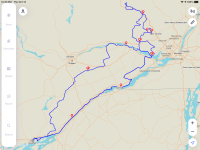
I recently did an 8 hour ride but I had mapped it on Google Maps. Since the route had multiple destination points, when I loaded the map on my phone, google maps did not navigate me through the route but instead it allowed me to "Preview" my route after I had reached my first destination point.
It's incredibly annoying and frustrating to have to keep stopping to look at my phone to see if I'm going the right way or even worse play with the phone while riding to make sure I'm still on the right roads. I just want to be able to bring the pre-created route on my screen and look down to find out where to turn to hit my next road without my screen going off.
Is there any mobile app that works best for what I'm trying to achieve? Bonus points if it 1) has an easy to use user interface when creating a map or 1.5) allows me to put in the Google Maps link and it creates the map on that app itself. And 2) Could download offline maps. 2 isn't as important but 1 is super helpful.
Thanks for any help, and sorry again if it's been discussed.