


Riding near Barrie or Wasaga have an eye out...S Ont anywhere
moving very fast and that looks nasty
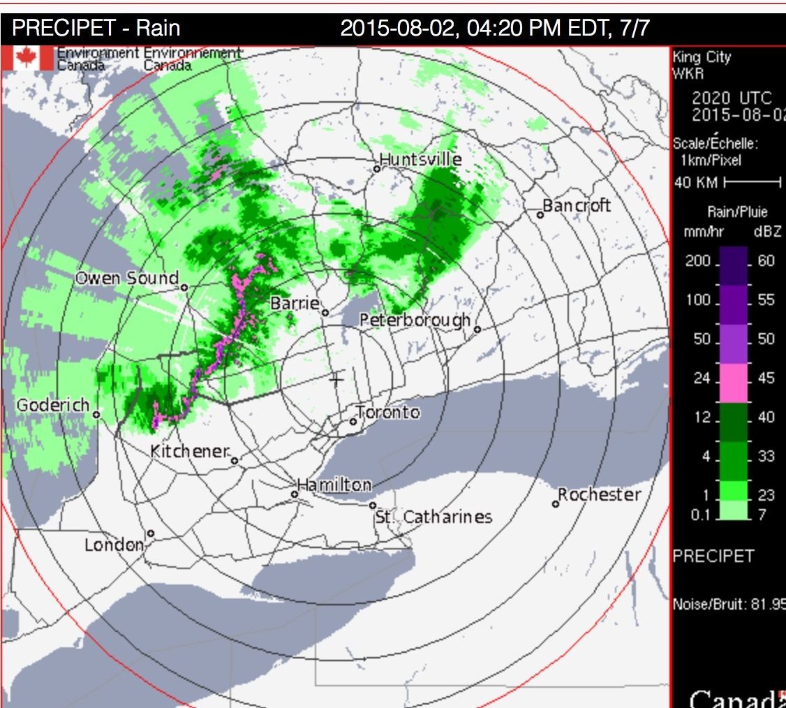
http://weather.gc.ca/radar/index_e.html?id=WKR
might hit further south later
Movie night sooner than later I think....nice out now tho. Toonie size hail ????!
I'll pass.
Updated 4.30 pm
Now the alerts are out for Kitchener
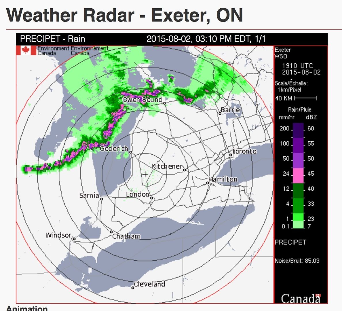
At 3 P.M. EDT, Environment Canada meteorologists are tracking a cluster of severe thunderstorms near Oliphant capable of producing local strong wind gusts and Toonie size hail and heavy rain. Motion is to the east-southeast at around 50 km/h. It will affect locales to the southwest of Wiarton up to 4 P.M. EDT.
Take cover immediately, if threatening weather approaches. Large hail can damage property and cause injury. Strong wind gusts can toss loose objects, damage weak buildings, break branches off trees and overturn large vehicles. Remember, severe thunderstorms can produce tornadoes. Go indoors and move away from windows and skylights.

moving very fast and that looks nasty
http://weather.gc.ca/radar/index_e.html?id=WKR
might hit further south later

Movie night sooner than later I think....nice out now tho. Toonie size hail ????!
I'll pass.
Updated 4.30 pm
Now the alerts are out for Kitchener
An isolated tornado is also possible. These storms are moving east-southeastwards at 80 to 90 km/h.
Last edited:


