Another upside to moving maps is they often give you an idea of what you are headed into. You can't see everything yet (I haven't seen one that conveys upcoming elevation at a glance easily) but you have a good idea if that corner collapses into a crazy decreasing radius just past your line of sight.
STRAIGHT? going to the sun
Best to ride West to East then you get to look down.
Last time thru the road was closed at night and the park wardens let us in 15 minutes before official opening so no vehicles in front of us.
My friend who was riding with us had his wife on the back and she hates hights.
Screamed from one end to the other.
I had them printed out by CAA and will be taking both versions with us, just in case. They are great and give fuel, food and lodging stops along the way. For this trip I changed up the stopping locations on the southbound trip via I-79 (my preferred route) to give us two longer days and a third shorter one. I got the I-75 one just in case I need to use an alternate due to winter weather to avoid the mountains. I really like having something I can sit at a table and work out in advance. I do have an I-75 book around here somewhere, but I'm not looking to do any sightseeing along the way this time.
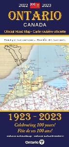
I still have and use Ontario paper maps in the insert of my tank bag when traveling around on the bike by myself. I don't have GPS on the bike, so that's my only option. Usually I just follow my riding buddy, (former truck driver who seems to know every road in the province), so I now use the ESR app just so I know where the hell I've been when he is leading.
I had them printed out by CAA and will be taking both versions with us, just in case. They are great and give fuel, food and lodging stops along the way. For this trip I changed up the stopping locations on the southbound trip via I-79 (my preferred route) to give us two longer days and a third shorter one. I got the I-75 one just in case I need to use an alternate due to winter weather to avoid the mountains. I really like having something I can sit at a table and work out in advance. I do have an I-75 book around here somewhere, but I'm not looking to do any sightseeing along the way this time.
I still have and use Ontario paper maps in the insert of my tank bag when traveling around on the bike by myself. I don't have GPS on the bike, so that's my only option. Usually I just follow my riding buddy, (former truck driver who seems to know every road in the province), so I now use the ESR app just so I know where the hell I've been when he is leading.
I saw the info they provided, that wasn't that helpful to me. I had pre-booked a hotel room (on the way down south of Charlotte, on the way up at the top of WV) and got gas when we needed a bio-break (with ~100 km reserve in case things went to crap). Tons of gas and food along the way so unless you are pushing out to the last drop, having them on the map didn't help me.
Try one of those stupid ontario visitor centres beside the highways. When cutting the fat, those would be near the top of my list. Prime land, expensive employees and few visitors.
Down south somewhere the Squeeze and I encountered a detour around a bridge that was out. After following the signs to the best of our ability we ended up back at the bridge on the same side as we started.
Down south somewhere the Squeeze and I encountered a detour around a bridge that was out. After following the signs to the best of our ability we ended up back at the bridge on the same side as we started.
I ended up lost as can be in the mountains there at night with only my stupid MapQuest map had to find a place to buy a full map. Was 4 hours I don't want to ever repeat. Driving around lost playing dodge the deer.
All you guys waxing poetic about paper maps clearly never travelled coast to coast back before the days of GPS's in a 70' long truck with a $150 10 pound spiral bound road-atlas that only showed the "big picture" with tiny blowups of the cities which may or may not get you where you need to go (and is probably out of date before you bought next years $150 slightly more up to date version), and a pile of tattered and torn state/provincial/city maps collected from every visitors centre and truckstop along your travels, and then being forced to get from A to B hoping it all worked out, sometimes in major cities like Chicago, Boston, or NYC while navigating through unexpected road closures, one way streets, and all the other stuff that pops up....often with nowhere to pull over and "re route" yourself. And you always had 2 rolls of quarters on hand at all times so you could always call the customer and check out your "last 10 miles" route to make sure it actually worked, all while feeding the payphone quarter after quarter for a long distance call.
GPS was the second coming of Christ for guys like me, especially when it got connected and crowdsourcing became a thing. Accidents with road closures, automatic redirect around it. Construction has an intersection or a stretch of highway closed...you know ahead of time. Major road reconstuction has the highway looking completely different (along with new/deleted onramps/offramps) in some area, the GPS was typically more up to date than a paper city map you bought 5 years before last time you were in the area.
I've never looked back. I don't get the "you can't get the big picture" thing when it comes to GPS - on your phone with Google Maps, for example...just zoom out. If you want to see where the next little diner or McDonalds or gas station or anything you could possibly want is, you just search for it. Then you look at the photos of the place to see if you want to go. Then a push of a button tells you exactly how long it'll take you to get there. etc etc etc etc etc.
Yes, you need to use some basic critical thinking and not follow your GPS into a lake or follow it blindly onto a forest access road while towing your 40' travel trailer (which is where I think some people fail), but it is seriously better in virtually every single way.
I ended up lost as can be in the mountains there at night with only my stupid MapQuest map had to find a place to buy a full map. Was 4 hours I don't want to ever repeat. Driving around lost playing dodge the deer.
This site uses cookies to help personalise content, tailor your experience and to keep you logged in if you register.
By continuing to use this site, you are consenting to our use of cookies.