GPS's for finding twisty roads? | GTAMotorcycle.com

GPS's for finding twisty roads?

CriticalCore

Well-known member
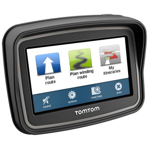
Curious what you guys do when looking for places to ride, I've been thinking about getting some sort of GPS with a feature to find windy roads that would be fun rather than just straightaways.

I've looked at some with most costing half a 1000 dollars, are there any that aren't ridiculously expensive lol.
 
Last edited:
I have an old garmin that i use on my ram mount but use it so i won't get lost. check out the cruising/ touring thread and sticky " the best roads...." by shanekingsley (thanks shane) . I planning on doing the parrysound/ huntsville paved route this summer for sure. google map/ streetview to get a better sense of the roads and mark down gas, places to eat and places of interest. I also just wrote some direction on paper and tape it to my gas tank for quick reference.
 
If any of you come across really nice roads that I haven't included in the sticky from the cruising / touring forum, then let me know and I would be happy to check them out and / or add them to one of the lists.

I think there are also apps/programs that have winding roads or twisty roads features - but I don't know those apps. I just do what DemonPig said and use Google Maps to find the ones worth checking out. Or talk to locals in a specific region to find the hidden gems.
 
"Two roads diverged in a wood, and I - I took the road less traveled by, and that has made all the difference."

Go exploring.
 
There is a reason they make twisty roads. It's to accommodate changes in elevations so look for roads on topographical maps.
 
my GPS has a feature called plan a thrill
choose start and end point
then 3 levels of twisty to choose from

the resulting route it spits out is seldom a good ride
usually just a longer way of getting somewhere on secondary highways

like suggested, google maps or just plain exploring work well
 
TomTom GPS does what you want if you can find one

tom_tom_rider_gps_rollover.jpg


https://fortnine.ca/en/tomtom-rider-gps

TomTom app has it for phones but not sure where you can find the older app which is much better.

Scenic is very flexible.

NEW: Curvy Roads navigation in Scenic
Posted on May 9, 2017 by Guido Posted in Scenic How To 5 Comments
I’m very proud to announce that with Scenic it’s now possible to navigate along Curvy roads to your destination and create routes with Curvy roads between the via points.

Thanks to a partnership with Kurviger.de this has been made possible. On their website you could already create Curvy routes and import them into Scenic through GPX, but now their Curvy routing is directly available in Scenic as well.
https://itunes.apple.com/us/app/scenic-motorcycle-touring/id1089668246?mt=8
Dirk says
May 13, 2017 at 00:10
I just tried that out: great! The Very-curvy-feature on kurviger.de finds most of exactly the same roads I would have chosen as a local. And the import into scenic is just two clicks – much easier than the export and import with gpx.

this is for Android
Twisty Road Finder

https://play.google.com/store/apps/details?id=com.logicstem.twisty&hl=en

I'd opt for Scenic with Curvy Roads if I was starting out.

Winding Roads in the original TomTom has served me very well even tho the interface is a bit clunky it's taken me on lots of totally fun rides I would never have sussed out on my own.
 
Google is your friend. If you know you are going somewhere do a bit of research before you go. You can find all sorts of things rather then just trust in a feature on a GPS for finding you a nice road. I plot my routes, research the areas with simple searches like "best motorcycle in Moab" or expand it even more "best riding in Utah". Tons of things will come up with peoples reviews and suggestions. Some of them even have a GPX you can download and use.
 
I check the Best Motorcycle Roads....but https://trips.furkot.com has all of the major sources for riding.

I will pick one or two I that are recommended but then let the GPS wander as well. We had this one "rave road" out west that turned out to be scenic but certainly not what riders described as exciting in the sense of twists.

The Winding Roads and Curvy Roads features often turns up short stretches of hilarity that simply don't make it to the reviews and would really be hard to sort visually on a map.

My best test was in West Virginia ....the riders recommended a couple of good roads and I let the Winding Roads loose.
Got what they recommended and a few more.
 
I usually use Google maps but you have to be careful and make sure you use street view to double check that the road you take isn't dirt or gravel. I rode with someone that had roughly planned a route using Google maps but didn't double check if they were actually pavement/tarmac. Turned out most weren't.

I have a Garmin and it has an adventurous route screen that allows you to tailor how you want it to route you to your destination.


It has helped me find some decent roads I otherwise wouldn't have taken. One of the routes it took me through helped me to discover this neat spot:
JYd52rYm.jpg


But this feature alone isn't worth the $$ of the GPS.
 
Last edited:
Slowbird. Your pic looks a lot like mine!
NP6V7bj.jpg


For OP. Save yourself the cash and use Shane's big map and plot a route on your phone. Those roads branch off to several other interesting roads. If you feel the need for a GPS later, have at it.
 
IMTvuVhm.jpg


That's really nice slider.

One warning ...turn off any twisty finder if your route goes through towns or you will find yourself wandering the very worst little streets...ask me how I know :rolleyes:

Tell us what phone you have and people can advise.
Used phones for GPS use are cheap and don't need a network.
 

Back
Top Bottom