Apps for Motorcycle smart phone use. Android or iOS | GTAMotorcycle.com

Apps for Motorcycle smart phone use. Android or iOS

MacDoc

Well-known member
Site Supporter
Thought this might be a popular place to stick your fav apps.

I just came across this as I was tired of trying to find the play button - this solves that BIG time :D

screen322x572.jpeg


https://itunes.apple.com/bj/app/megaplay-best-car-music-player/id926320613?mt=8

There might be an Android version.

•••

My other GoTo Apps for off network are TomTom, CoPilot ( in Australia ) and GoogleMaps for local stuff on network

My phone is mounted on

beartoothgps.jpg


http://www.rammount.com/part/RAM-HOL-UN7BU

Audible for books which I really fine makes the time go by quickly on the slab.
 
How do you find that mount, it just looks scary to me, $500+ electronic just hanging out there. I have used RAM mounts and like them, guess I am just a little paranoid
 
Never had an issue with it. The design holds very tightly as long as you seat the phone properly.
Use it every day ...

That photo was the top of Beartooth Pass - we did 10k over 3 weeks - both using the X-mounts.
 
Last edited:
To secure the phone to an x-grip if you plan to be riding on rough roads or trails, these work great: http://www.twistedthrottle.ca/ram-m...4thCyy3IKy_Vsewlemrsq8byskaImTc152xoCvhHw_wcB

51OrBIUtWcL._SX425_.jpg


As for apps... I am on Android.

If I am routing somewhere, I use Here if no data coverage, Google Maps or Waze if data is available.

If I want to just watch where I am or am going on the map, I use OruxMaps loaded with either Open Street Maps or Back Road Mapbooks. Orux is also great at recording my track and auto uploading it to my dropbox when I get home. Orux is decent for opening a GPX and following the track... (not routing, just follow the line on the map). There is a bit of a learning curve at first though... takes some tinkering and playing around to get used to it.

I use Scoutlog to display or save any POIs that I need or want to save.

Mac, I though you use a Sena? Do you know that once something is playing you can pause/resume just by long pressing the main dial? And forward to the next track by pressing the dial and turning it clockwise. Short press for the intercom. Also, if you use an app like Poweramp, you can set it to auto play once connected to a bluetooth device.
 
Is there an app where you can plot your route?
 
Is there an app where you can plot your route?

Android or Apple?

For Android there are Voyager and Road Warrior (and most likely a few others too)... but I haven't really used either and not sure how well they work on the road.
 
Android.

I am really starting to hate my Garmin. Took me an hour to plot a route today. Smfh
 
it sucks that google maps doesn't allow you to send multi point routes to the maps app... that would be ideal. If anyone knows how to do that, please share.
 
Android.

I am really starting to hate my Garmin. Took me an hour to plot a route today. Smfh
Are you using Basecamp? Not sure what would take you an hour unless you were adding tons of individual waypoints and plotting a trip across N. America 20 times and they all need to be different.... Even then I can't see it taking an hour.
 
Are you using Basecamp? Not sure what would take you an hour unless you were adding tons of individual waypoints and plotting a trip across N. America 20 times and they all need to be different.... Even then I can't see it taking an hour.
Yes basecamp.

I cannot see the little roads & don't want to take the major roads because they're not twisty enough. I am using a car gps BTW. Don't want to shell out for expensive motorcycle gps
 
Not GPS-related and only really useful to those with a comms unit, but I really like Wx Alert ON for iOS -- Basically another weather app, but sends push notifications for select areas when there is an alert out from Environment Canada. I know TWN and a few others just started doing this, but one benefit of Wx Alert is that it uses its own sound files...so you really can't miss when an alert is out in the area.
 
Yes basecamp.

I cannot see the little roads & don't want to take the major roads because they're not twisty enough. I am using a car gps BTW. Don't want to shell out for expensive motorcycle gps

Well that's why your Garmin & Basecamp combo sucks. Granted, I'm in a similar boat, as I am still refusing to spend $500+ on a motorcycle GPS and just use my iPhone for voice/turn-by-turn, and an old Garmin Nuvi 350 in a RAM mount when I want visual. Neither can do routes though, which does suck....One day I'll probably break down and buy a Zumo if it is on sale.
 
Yes basecamp.

I cannot see the little roads & don't want to take the major roads because they're not twisty enough. I am using a car gps BTW. Don't want to shell out for expensive motorcycle gps

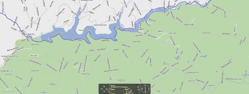
Why can't you see the little roads? Are you sure the maps are installed?


Make sure the detail is set up high enough to see smaller roads, it is at the bottom
 
Why can't you see the little roads? Are you sure the maps are installed?


Make sure the detail is set up high enough to see smaller roads, it is at the bottom
Problem is, I have to zoom right in to see the smaller roads. I will try your recommendations.

Thx
 
Problem is, I have to zoom right in to see the smaller roads. I will try your recommendations.

Thx

Don't think there is any getting around that. It would be a real mess to have every road show up when zoomed out. Not sure any mapping program will do that, just looked at Furkot and it does basically the same thing, zooming out roads start disappearing, when you zoom back in you get more detail and obviously more roads you can see. Furkot looks like it shows a bit more road detail further zoomed out though compared to basecamp.
 
How do you find that mount, it just looks scary to me, $500+ electronic just hanging out there. I have used RAM mounts and like them, guess I am just a little paranoid
Its fine, I have done 220km/hr with my phone mounted on it... (closed circuit of course)

Apps I don't leave home without:

Waze: Navigation, traffic and Cops - Mostly when riding local
Copilot GPS: Any road trips, I load my route and takes me there through the most twisty routes according to my setting. I also used it in Spain and Portugal. No data needed
Harrry's Laptimer: Race/Track application only


These are the main ones.
 
Not GPS-related and only really useful to those with a comms unit, but I really like Wx Alert ON for iOS -

Thread title is Apps....no type specified ..all good Apps welcome but maybe specify which platform.

Wx actually sounds useful for our coming trip in June...how far out can you get alerts - we are planning about 500 km a day average.
 
What can you use to plot routes on an iPad? My iPad fits great in the map pocket of my tank bag.
 

Back
Top Bottom