Riding Down Under - Tropical Cairns Australia | Page 5 | GTAMotorcycle.com

Riding Down Under - Tropical Cairns Australia

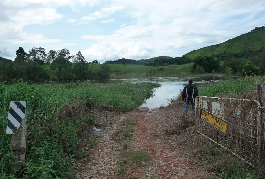
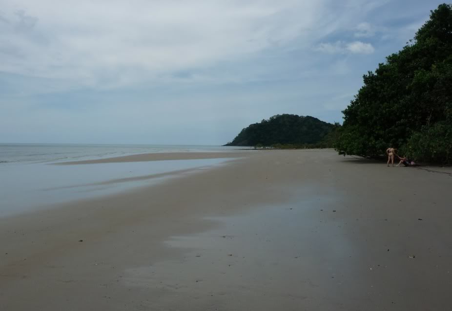
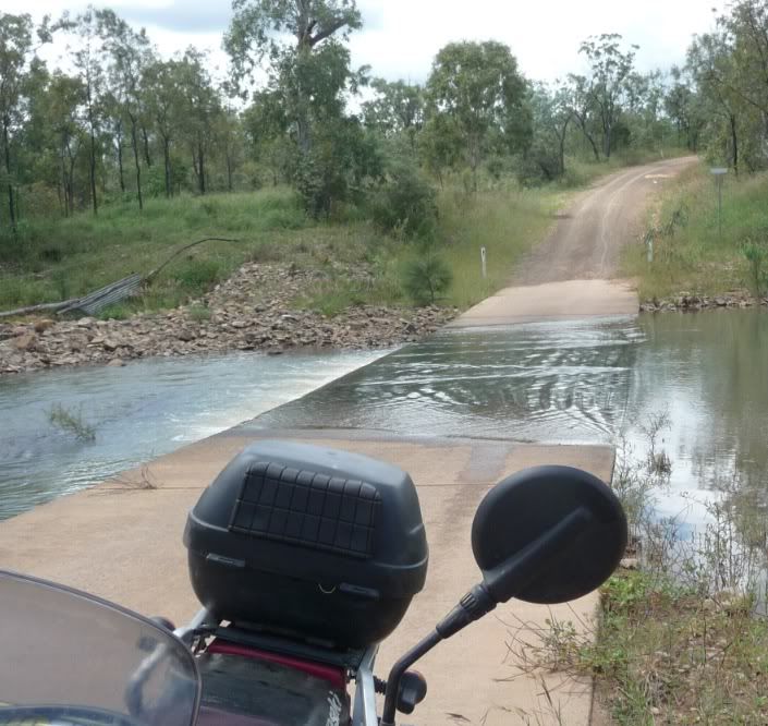
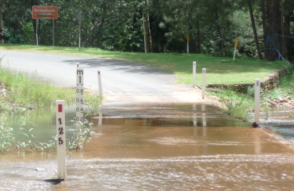
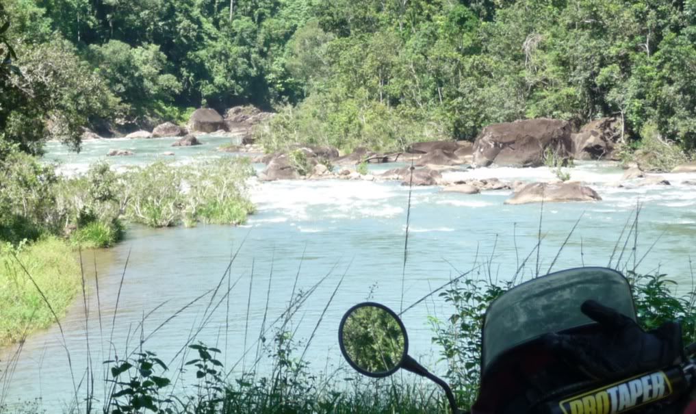
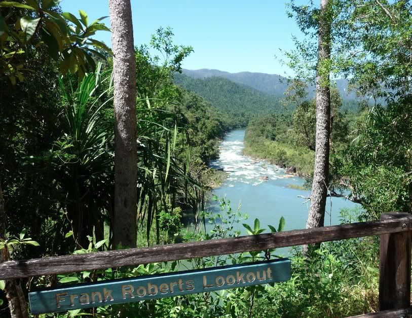
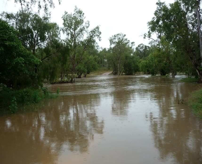
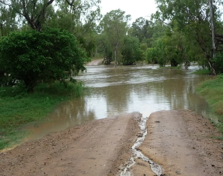
This was my goal today - the other end of the marathon dirt road ride last week - we went 100 km on dirt through creeks and another small river only to get turned back by this from the other side.....we were just 8 km from our destination last week and had to turn around. Was even higher today

Playing in the rain - actually was dry the first 100k of the ride
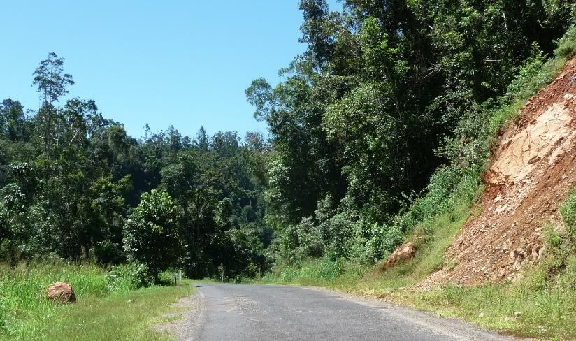
Just started as I was slip sliding my way to the other end of the ride we could not complete last week....only8 km short of the highway.

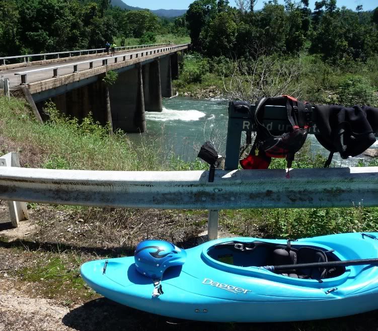
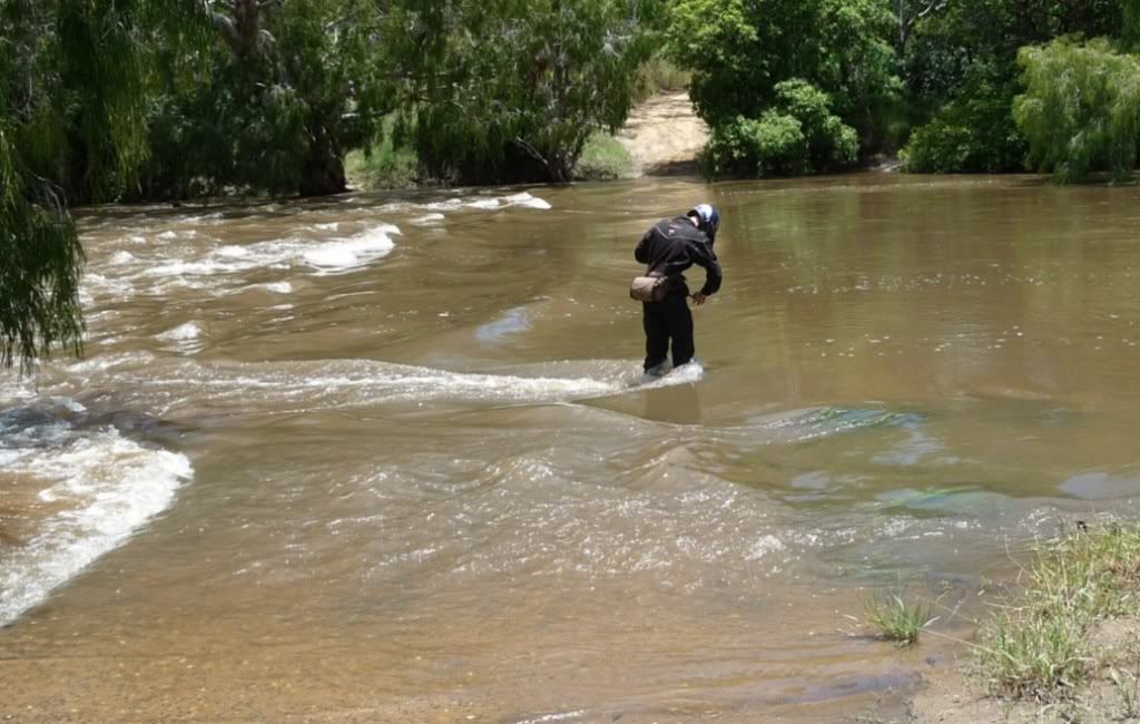
Last weeks turn around point - fortunately it was a dry ride the 100km back
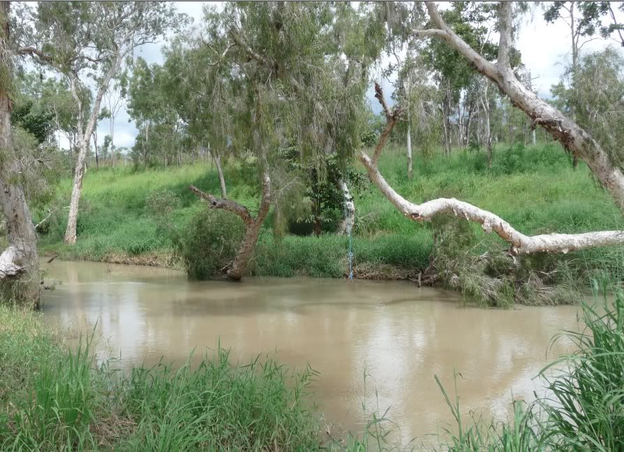
riding partner almost fell in - damn stuff was moving fast.- it is a concrete causeway underneath

Screenshot2012-03-07atMar72012105411AM.jpg


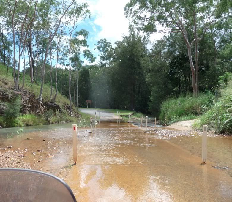
Wasn't gonna be passable today either !!!!!

Screenshot2012-03-16atMar162012124316PM.jpg


Screenshot2012-03-16atMar16201210602PM.jpg


and it was raining a bit so slippy even the short 8k from the highway....got my new boots muddy - a bit worried about the traction on them but spots were so slippery underfoot and tire i doubt the hiking boots would cut it either.
Knobby front tire was a treat - rear was slithering but nothing of great concern as was taking it easy being on my own.

Again dried out but started again just before I stopped for lunch where I am sending this from.

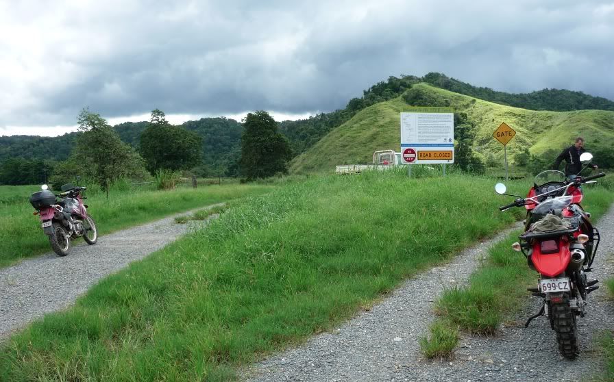
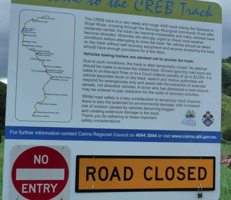
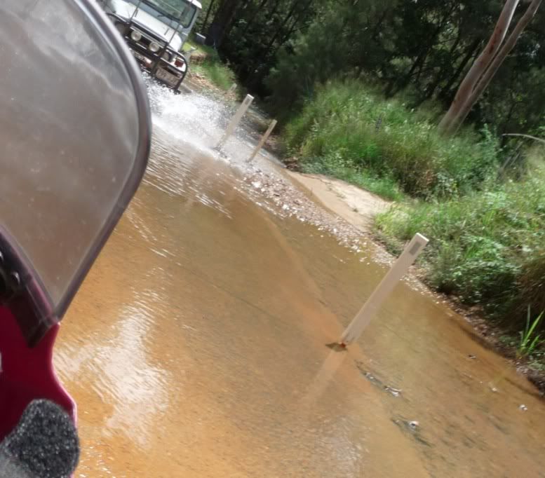
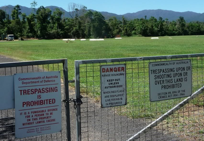
This highway was technically closed :D
one driver refrained -
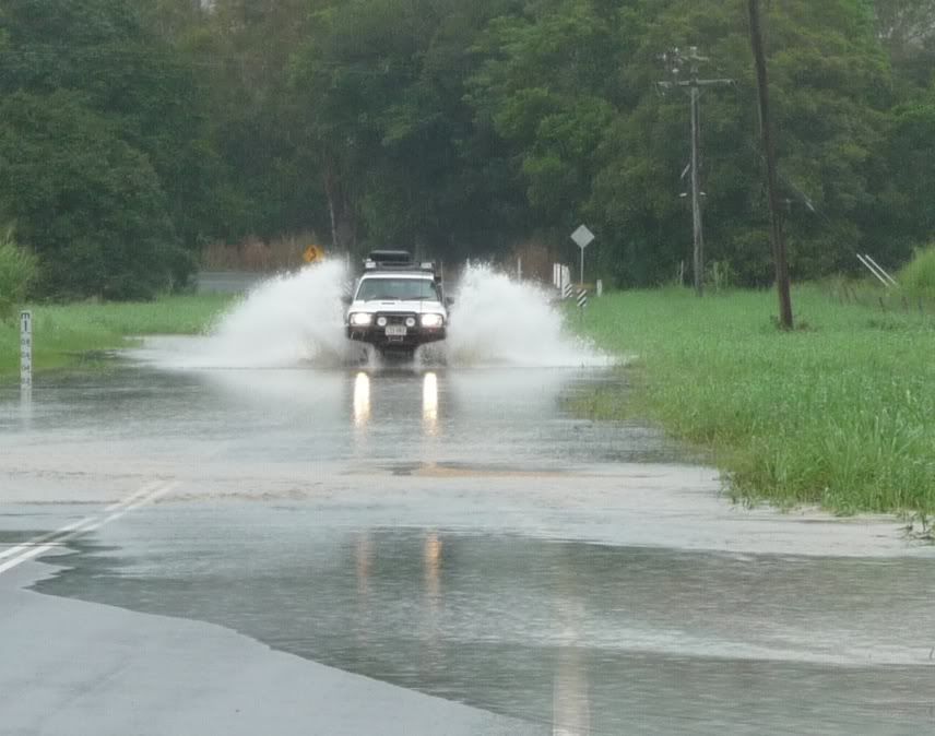
Technically the road was closed according to the signs but hey it's an adventure bike

Screenshot2012-03-16atMar16201210503PM.jpg


- I went through easily then this guy had some fun too.

Screenshot2012-03-16atMar162012124905PM.jpg


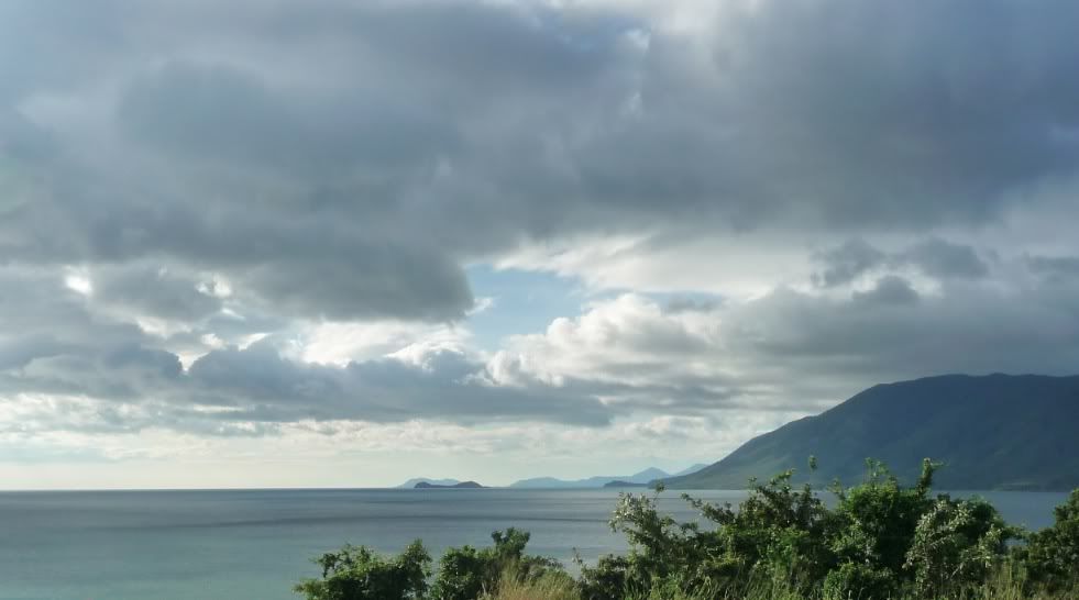
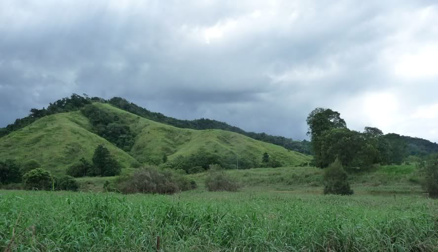
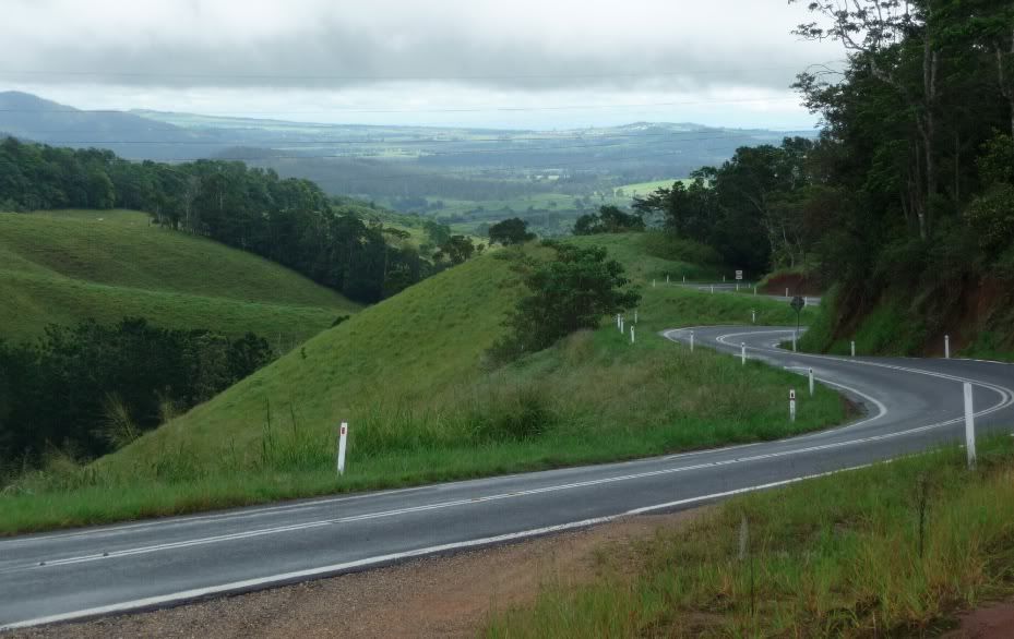
Then headed home down the coastal range from the North and this must have been fun last night -

Screenshot2012-03-16atMar16201210521PM.jpg


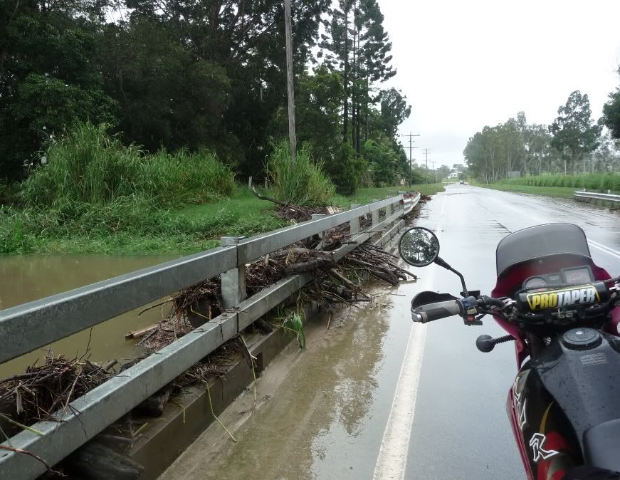
This is THE major highway west of the coast and big trucks come through - this was likely a couple feet over the road last night - good reason they warn to slow down and it's single lane to boot. You can imagine what happens here when a cyclone hits.

Screenshot2012-03-16atMar16201210730PM.jpg


Screenshot2012-03-16atMar16201210824PM.jpg


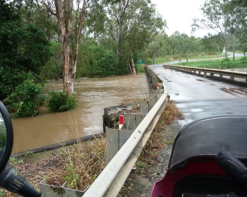
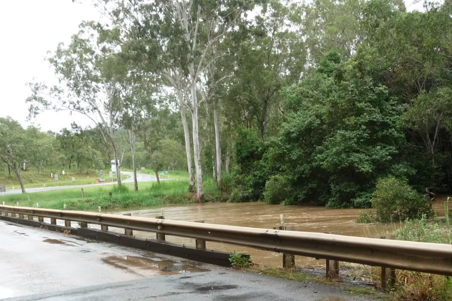
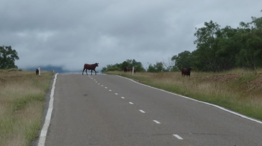
water is not the only hazard - no fences in many areas and again - this is a major highway tho not a lot of traffic today.

Screenshot2012-03-16atMar16201210704PM.jpg


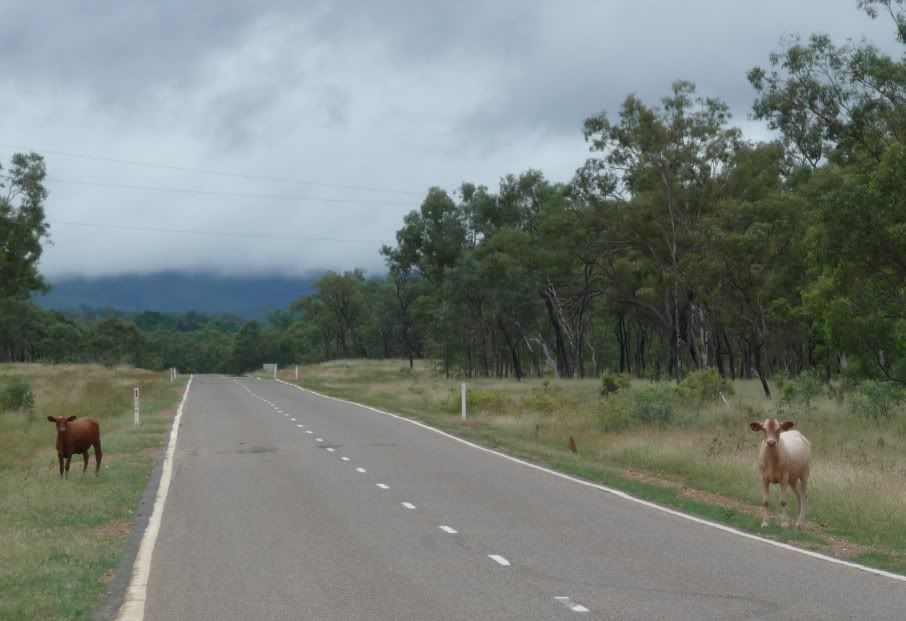
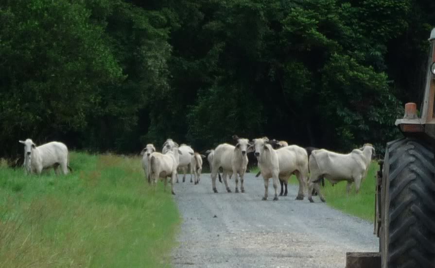
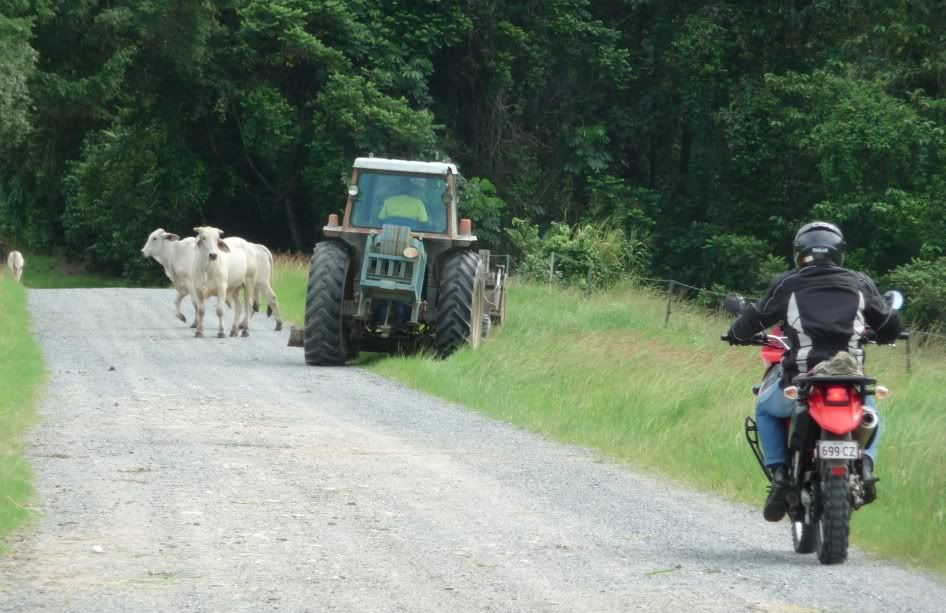
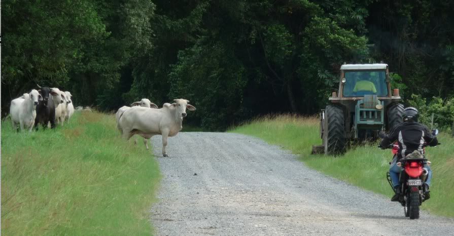
free range steak indeed!!!!

Screenshot2012-03-16atMar16201210634PM.jpg


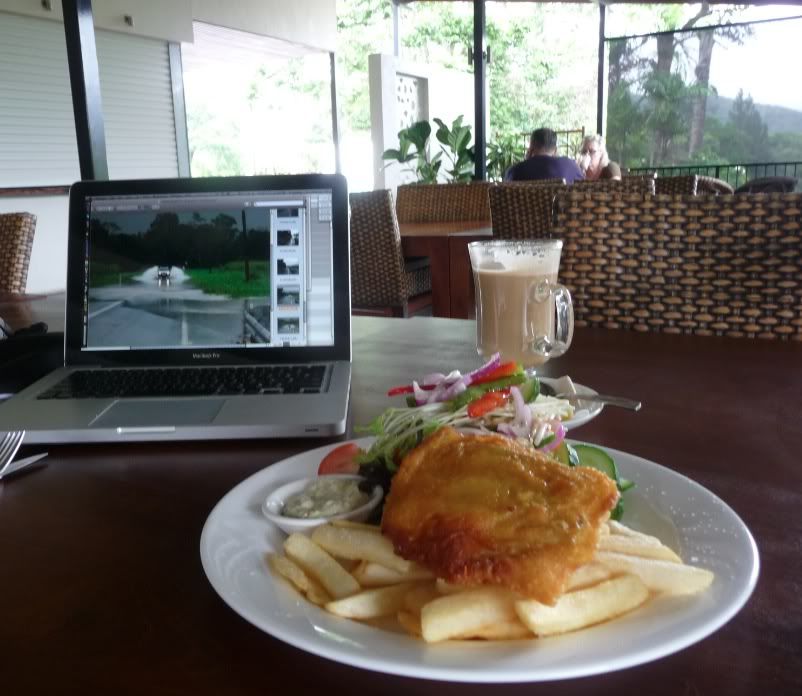
It's pouring rain just now so will hole up for a bit
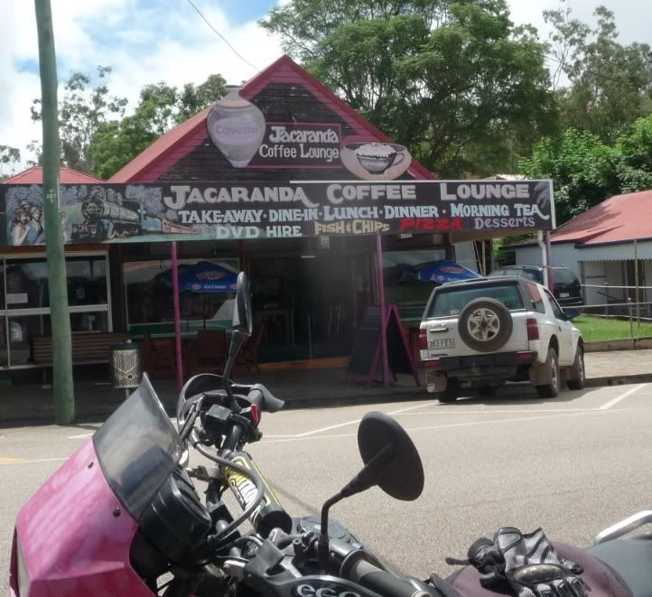
Lovely spot to wait out the rain and local fish is the barramundi - excellent - something in the order of pickerel.

Screenshot2012-03-16atMar16201212242PM.jpg


••••

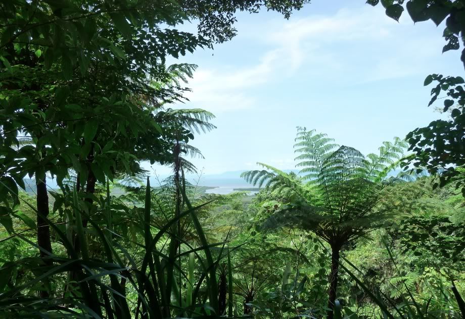
The ride down the Rex after lunch was hilarious - deluging and felt like riding down a shallow smooth stream bed - damn that thing is steep in parts still not all that aware of how the knobbies do in the rain.

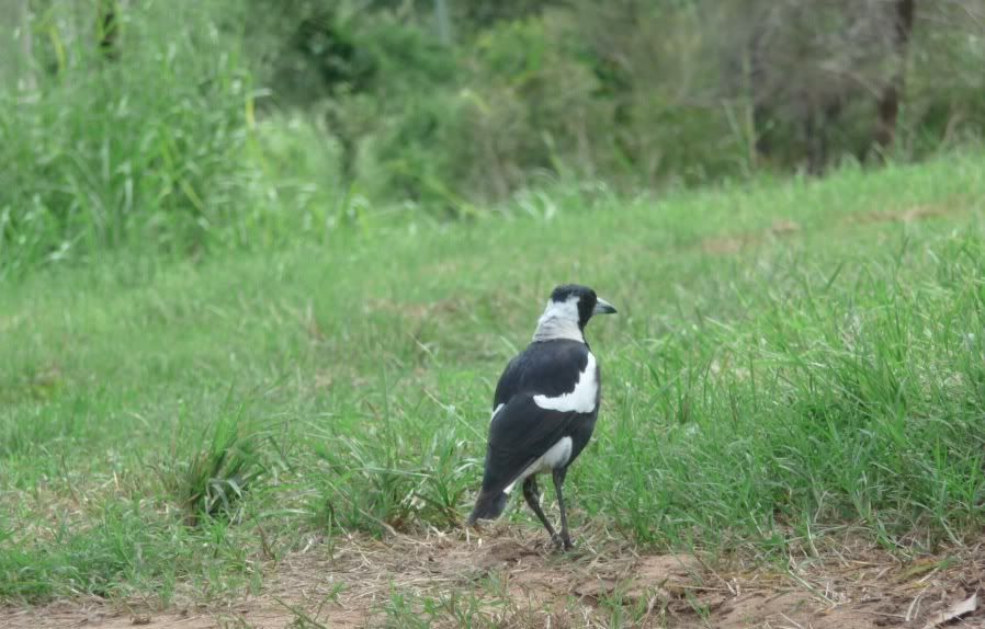
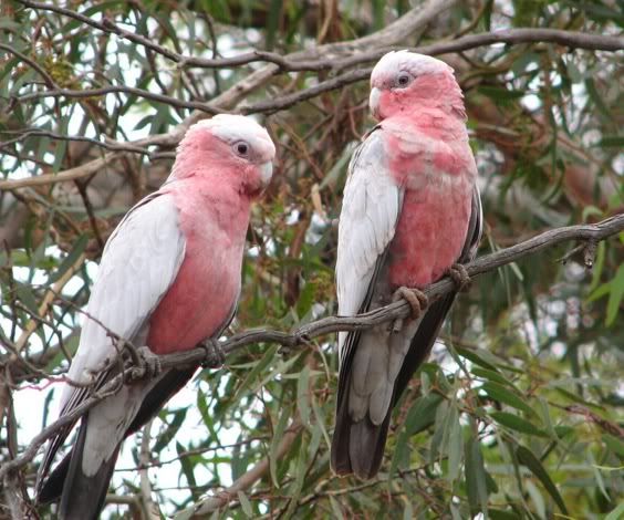
330k ride in the wet season - not a bad day and some lovely flocks of galah on the way to the Mitchell turn off.
Pair of wampoo as well - damn they are glorious. That highway was just flat out deserted early in the morning....cept for the wildlife and not so wild life...I think the size of the mcycle confuses the cattle - they take their time moving and then startle.

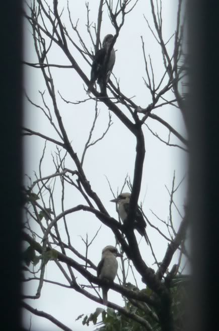
Birding in the wet season here is an exercise in frustration - lighting is awful - these are big birds - cockatoo family.
Called the galah.
Was a whole flock feeding on the edge of the road. ( not my pic ) Not a chance given distance they flew off to and and poor light. Still there was about twenty and quite a sight.

Screenshot2012-03-16atMar16201253623PM.jpg


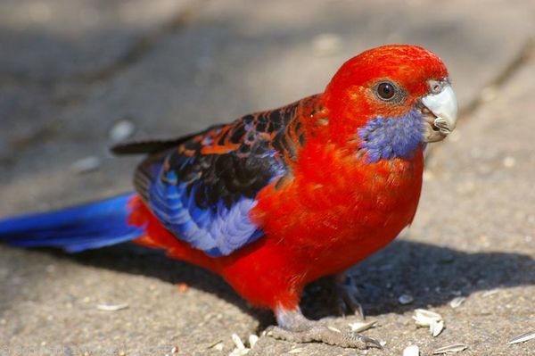
pair of these took off across the highway as well .....got out early - tho it was grey was still a lovely ride early on and even the dull light could not dull the glorious colours.

The highway up there is sooooo quiet in the morning.

228180067_8b57407713.jpg


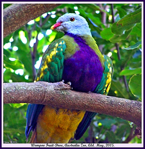
Wampoo one of the fruit doves that are in the area - could be a whole vacation just chasing dove varietals.
 
Last edited:
No riding today and was up early ( here working )

Kookaburra's sit in an old gum tree

Yup

Screenshot2012-03-17atMar172012103812AM.jpg


They were making an hilarious racket all morning and finally posed for this through the open fretwork.

Shooting into the light but not bad for little camera at long range.

I laugh every time the local gang starts up here....right out of Tarzan - hear them here.

http://www.environment.nsw.gov.au/resources/nature/daceloNovaguineae.mp3

you get a bunch going and they wind each other up
gorgeous big birds

Jude's ( GF ) dad used to get them to eat from his hand
 
Gonna bring a kayak next time :rolleyes:

144 mm of rain over night - just under 6" !!!! and more coming. Back yard is a swamp.

anyone got plans for outriggers for mcycles!! sheesh
 
This is a great thread MacDoc. I would love to tour OZ on my bike. I have been a long time member on Ehmac and know your name from there.
Keep on posting you progress, very enjoyable.
 
Riding progress right now is stalled out due to flooding...Barron River is in full flood. Very lucky I got that ride in.

barronfalls320.jpg


3898906-3x2-940x627.jpg


this is the main arterial road

Cairns-WebUsual-CP20MAR12P002-CC254410-ROAD.JPG


and one area of town

3898528-3x2-940x627.jpg


lots more coming.

•••

It's not a bad idea to come to this area from Canada as you can get a one stop flight and there are a number of mcycle rental places.

http://www.bikingaustralia.com/

Adventure bike is the best. 3 weeks would be minimum.

Touring the rest of Aus would not be feasible from here - as it's so far between places.

Aus is very close to the size of the continental US with 5% of the population. But there is a lifetime of stuff to do in this area on an adventure bike.
 
Hi there MacDac

I am new here to forum and Canada, and have come over from Australia! I think I am doing the same thing you have been doing but in reverse! Hopefully the Canadian summer is a little more forgiving than qld, The pictures you have are amazing, and you get used to that much water up there, it really shuts the whole north down...

Just a random note, my Brother is actually one of the National Park Rangers, based up in Cooktown. So if you are planning on heading further north. If you need a contact that far north, send me a PM and ill forward on his details.
 
Thanks - may not be this year but I'll be here three months plus each year.
Where are you in Canada?

•••
11 pm here

122 mm of rain in 2 hours - that's heavy even for here. Almost having to batten the house down cyclone style. Had to rescue a few bits of electronics at risk. At least it's warm. City likely to be cut off both directions for a bit. In the past it used to be cut off for a few weeks at a time except for boat.

pretty deep - even the creek near the house is almost over the road.

3898528-3x2-940x627.jpg


and of the course the roads here had to make the 40 most dangerous roads in the world list

http://artsonearth.com/2008/08/40-most-dangerous-roads-in-world.html


The Gillies Highway, which is well-known for its 200 corners in the 20 km road, has caused several tragedies. One of the worst accident killed 6 children. The kids were not carried by a school bus but a normal bus carrying them on a ’school trip’.

30. Captain Cook Highway – Australia

30-Captain%2BCook%2BHighway.jpg


Despite the fact that the Captain Cook Highway is a short Queensland highway and also one of the most popular routes in Australia used by lots of tourists, the highway is regarded as one of the most dangerous roads in the country.

9 people had to be rescued from their vehicles a few km down the coastal highway water was rising so fast
and to the north a VW size boulder has come down to block one lane.

561031.jpg
come around the corner in the rain and find this occupying part of your lane.

I'm gonna try to go up Copperlode tomorrow see what's going on there....:D ....hey it said adventure bike right .... ;)
 
Last edited:
Pretty much cut off at this point

479539-big-wet-up-north.jpg

CUT OFF: The Captain Cook Highway is cut by floodwaters north of Cairns. Picture: Cassey Brian
Source: The Courier-Mail

This is the highway out of town to the the north and the southern route is closed at several points.

NORTH Queensland is braced for a week of flooding with highways cut, schools closed and townships isolated.

Cairns, Townsville and Mackay have been swamped in a torrential downpour with a tropical low and a monsoonal trough causing traffic chaos, flash flooding and mudslides.

Up to 500mm of rain has been recorded in parts of the state's north in the past three days.

Weather experts predict the tropics will bear the brunt of flooding as the active monsoon trough moves south before swinging back north again by the end of the week.

Disaster officials plan to resupply isolated Gulf townships and cattle stations with fresh food and medicine.

They have warned motorists of the deadly threat of fast-flowing floodwaters.

Two-metre high seas have pounded exposed coastlines with serious beach erosion reported in numerous beachfront suburbs from Port Douglas to cyclone Yasi-battered Cardwell.

Flood and severe weather warnings are current for many areas, with river systems rising.

Two Cairns schools and several daycare facilities sent children home early yesterday.

Ingham is again under threat with the Herbert River rising and some localised flooding yesterday in the aftermath of five catastrophic flood events.

"Anything can happen but we hope there is nothing like a repeat of the disasters of last year," Ingham Mayor Pino Giandomenico said. "The next 24 hours will be tell-tale for us."

Townsville Mayor Les Tyrell said the March record of 696mm looked set to be broken under a week of heavy rain with 300mm predicted on top of 347mm so far this month.

"Both dams are overflowing and if it stops raining we've got enough water supply to last the entire city for the next two years," Cr Tyrell said.

In Cairns, freight supervisor Kevin Ward said flooded roads and heavy cloud cover were wreaking havoc on the road and air freight networks.

Extra swift-water rescue technicians have been deployed north to Mount Isa, Ayr and Home Hill while Weipa, Normanton, Georgetown, Cairns, Innisfail, Ingham, Townsville, Ayr, Bowen, Proserpine and Mackay have been warned to expect heavy rainfall in excess of 200m in the next 24 hours ahead of a week of wet weather.

The Bruce Highway, estimated in a new report to cost north Queensland more than $5 million every day it is closed by flood, was re-opened to the south of Cairns yesterday.

Burdekin residents on Sunday watched the Haughton River break its banks. Beachside suburbs Yorkeys Knob and Holloways in Cairns face being cut off for a second day and large boulders and a mudslide have blocked part of the highway north to Port Douglas.

Late yesterday, the 24-hour totals included Flaggy Creek on the Atherton Tablelands with 388mm; 250mm in the Mulgrave catchment; and 224mm at Innisfail.

GF daughter called into work at midnight with several suites flooding - at her Novotel...it's compounded by high spring tides along the coast and some strongish winds for this normally rather surf free section of coast protected by the Great Barrier reef.

••

next morning - as if rain isn't enough = now tornados in the town south of us

3900458-3x2-700x467.jpg

http://www.abc.net.au/news/2012-03-20/mini-tornado-cuts-through-townsville-suburb/3900192

Once biz slows down will get out for a careful ride.
 
Last edited:
Ah I have just moved to London, itching to get on a bike and get away.

Wow you got some serious weather there at the moment. My old folks are trying to make there way up that way right now with a caravan. Which will be beyond interesting for them o_O
 
Finally got some sun - got wet but dried off -
almost got nailed again with a little cell that intercepted me but over now -

Absolutely pissing down rain at Skybury

A nice morning riding up the Palmerston since the Gillies was closed.
Have to add another road hazard to the list.....wild pig.Saw one dead by the highway. Big chunka pork - would not want to hit that even with a car.

- wet noon at Herbertville after a having fun on that Ravenshoe - old Palmerston HWY - will go back there as it started to rain but lovely mix of rainforest and open farmland and quite twisty. Saw a longish black snake that was pretty quick - did not stop as he was a 3-4' long and there ARE some nasties about.
Given his speed would not have got a photo. Asking GF what it was - had a triangular shape to the body.

Update - one of the other riders thinks its a Black Whipsnake

Black-Whip-Snake.jpg


Remarks: The black whip snake is an active diurnal species, which is occasionally semi-nocturnal on warm nights. Considered to be Australia’s fastest moving snake, it is nervous and retiring. It will not bite unless provoked. It is an egg layer and may produce up to 20 eggs in clutch. It feed on small reptiles, frogs, mammals and insects. Although the exact potency of its venom is unknown, bites from large specimen are regarded as potentially dangerous to man.

apparently the fastest side winder snake in the world. Sure has the triangular shaped body.

Also a flock of gorgeous yet to be identified medium sized parrot family in the rain forest section of the Old Palmerston. Lots of red - mostly red around the head then into blue with distinct white tail feathers when flying.

Took the alternate western road from Herberton to Mareeba and decided to hit Skybury for late lunch and coffee.......just got gear spread out in the sun and soon raining so hard had to migrate inside.

Just a small cell but nailed me dead on.

Screenshot2012-03-21atMar21201225243PM.jpg


slowed now - still can't see the next tree tho.

Barron River was in full flight yesterday

Screenshot2012-03-20atMar202012121157PM.jpg


had to laugh at the ironic sign.

Screenshot2012-03-21atMar21201230653PM.jpg

Bridge you say???

Ended up with 350k today - nice after all that rain. Got in a short spin up to Kuranda but too wet yesterday.
Was fun coming down from Kuranda finally had dry enough roads to push the cornering speed a bit.
Then it started to sprinkle so slowed up - was treated to a nice rainbow as I came out the bottom.

Tomorrow looks sweet. More pics when I get to the high speed coffee shop - will try and upload a short movie of the Barron - biggest I've seen so far.
 
Last edited:
Cows, cassowary and The Creb track...

Got off a tad late to meet Eammon in his little corner of paradise at the very end of Stanton Road but we slipped through Buchan's Point mess just about as they were getting ready to close up at 8 am for a major repair effort and thanks to me chasing a rainbow photo ( marginal results ) we just about had the road to ourselves

He has the same bike but a newer model - KLR650s you can see some changes here. But same old oil can on stilts design

twinklr.jpg


The Cook Highway north from Cairns is always a sweet ride along the coast but the rains brought a lot of slides with it.

buchanpoint320.jpg


Underneath this debris are boulders - one the size of a cube van that highway crews were trying to blast apart. They were drilling it as we passed the slide area.
We snuck through almost the last before they closed it for the morning and had the road to ourselves - nice when it's a sweet twisty along the Pacific Ocean.
It is rated one of the top drives in the world with good reason. Shot this from the lookout this morning looking back to Buchan Point where the slide and road closure was ( there were minor slides along every road I travelled )

rexlookoutmar22.jpg

Was a really nice day after a week of deluge.

Eammon led the way to the beginning of the Creb track after coffee and a sandwich at Daintree Village. He had to face down some fractious cattle and we played dodge em with a tractor in the mix. Such INTERESTING road hazards. There was a lot more going on here than the photo shows - one of the young ones leaped the fence and there was lots of milling and false starts in various directions.

Screenshot2012-03-23atMar232012123915AM.jpg


Okay - the bull was clearly pleased at facing down the the tractor

Screenshot2012-03-22atMar222012111006PM.jpg


Eammon discovered one good use for his rather loud exhaust getting the bull to move - I guess the bull figured after the tractor Eammon was an easy mark..... ;)

Screenshot2012-03-23atMar232012123934AM.jpg


A bit further along a small but agile calf was grazing an edge of grass with nowhere to go - so had to dodge his antics in both directions.

Travelled on to the beginning of the Creb Track and the end of that track for us

Creb-nofurthertoday.jpg


where it crosses the Daintree ( think submersible needed just now ).

Crebclosedwithgoodreason.jpg


People get stranded on the Creb - part of the issue is a type of clay that if wet gives no traction at all - you cannot even walk on it. Locals use chains but far too many end up stranded - and the penalties are severe - have a read

Crebclosedsigndetail.jpg


and some video of the track

[video=youtube;Mfn3Bdnohyo]http://www.youtube.com/watch?v=Mfn3Bdnohyo[/video]

It is truly lovel country tho so you can see the appeal - about 60 km of coastal challenge all te way up to Cooktown. Dozens of stream crossings and steep hills - some severe even for very experienced drivers.

Crebtrackcountry.jpg


Retraced back to the Daintree ferry up past Cape Trib and that is a lovely ride when not too crowded - varied surfaces - some slippy.
This looks out over the mouth of the Daintree and the whole ride up weaves in and out of the rain forest.

Daintreelookout.jpg


Streams, small waterfalls - twists and turns, water over the road - blind hairpins with the occasional tour bus.....much fun

Eammon spotted a cassowary clan crossing the road ahead - a van had slowed after seeing them- I was too far back :(

I missed the best shot of the day further up. I was in need of a break and holed up at a beach bistro a few km past Cape Trib but before the river crossing.
Eammon continued on and said he managed to bump his way across and back tho he gave himself a one in ten chance of falling in. No pictorial record tho ....will check it out another day carrying less valuable gear in the top case and less tired. Was out of water and needed another coffee by midday. Gorgeous beach
CapeTribbeach.jpg


and nice facilities including a pool and decent food. Might take GF up for a couple days. Some good idea of the setting here.
http://www.capetribbeach.com.au/

Too late to sneak back in the narrow time window of the Cook being open so had some fun going up the Rex - was good to see another rider on the same bike also with knobbies so gave me some confidence in mine in the corners. Really is a sweet bit of twist and first time I had a go uphill and in the dry. Been feeling more comfortable with the front end skin. Knobbies on pavement are a new experience for me.

This is a good summary of the major riding roads - all world class - in the area - The Rex being the furtherest north and perhaps the steepest and the Gillies long and continuous with 200 turns in 20

BIG_M_753.jpg


pics of the various roads here tho none does them justice.

kmhttp://www.bikingaustralia.com/the_region.htm

Passed a pair of odd looking trikes - loaded with 3 people each and no sun protection......crisp fried most likely by the end of the day.

Took a break for pie at a road house and then over the Quaid and Black Mountain Road( quite dry ) to Kuranda and home.

Only one near miss with a yahoo 4x4 deciding to take the inside of a curve on a muddy slippy bit of blind corner - the small problem with his line being I was occupying that space ( quite correctly ) at the time.

Forced to actually haul the KLR to a halt while he slithered back on to his side of the road and the top side of the curve at some speed...bit of quasi-good natured yelling and shaking of fist and it was all over - hugged the edges a bit more after that. ;) ....when my heartbeat got back down.

Tall 4x4 grill looks awfully menacing flying by too close for comfort but kudos to the driver - I'm sure he did not expect to have a mcycle materialize in front him on a fun bit of muddy twisty.

Easy ride home from there - exited on the Kuranda road and loafed behind a tandem dump truck wending his way down with a tail of traffic.

Actual today was 11 hours just realized - crashed and burned when I got home - catch up on some missing sleep and let Celebrex do it's magic on aches and pains.
 
Last edited:
Took off early on Sunday March 25th as it looked to be the only dry day.

March25thloopmap.jpg


Travelled up the Palmerston again as the Gillies is still closed due to flood damage so made for a longer day.

However the Palmerston has it's own charms :D

Palmerstonsweepers.jpg


Perfect day to start but got wet in the Misty Mountain area - had thought about redoing that Old Palmerston Hwy but not in the wet again.
Cleared up but missed my turn for Herberton, backtracked just a bit by way of the Barron River Road - very nice - part paved- part dirt. That's why the extra distance as the route was originally just shy of 400.

Finally got into Herberton and had early lunch and chatted with a Cairns rider out for the day on his road bike - there were quite a few out - mix of machines.

Lovely food and for once very good value. Chitchatted with the owner a bit as she was on the look out for new binocs and saw my Zeiss roof prisms....she was startled how good they are in a very small format.

JacarandaCafeHerberton.jpg


Herberton has a long mining heritage and the hotel in town shows the early pre a/c designs to keep things cool.

RoyalHotelHerberton.jpg


Then on to the Petford Road - had no idea what to expect from the map. I did NOT expect a size large windmill tho.

Windmillinmiddleofroad.jpg


The early part was very nice up and down twisties but there was an ominous sign about "not suitable for caravans" which suited me just fine but wondered what was coming up on the jaunt.

Well - first it switched to a weird mix of dirt and pavement with no rhyme or reason - then dirt with creeks....lots and lots and lots of creeks

streamcauseway.jpg


....small and large and way to many to keep track of.

widestream.jpg


you can figure why the shot is tilted - trying to shoot and not get drenched....

Truckaction.jpg


The into Irvinebank which you practically need amphibious to live there as the river runs all through it.

Irvingbank.jpg


After that got a notice flood damage next 53 km - urk .....but had fun into ups and downs into numerous creek valley's - some only a hundred meters apart.

Most were easy and causeways but a few unimproved and a couple in the 18" depth tho they were smooth to go through - was pretty drenched to the waist by the time I finished with a few splashes on the helmet from having fun at some speed.

The ones without causeways we smallish but they can bite with deep potholes hidden so I take them slow and one edge or the other where I can see riffles.

Riding solo I tend to be a bit more cautious as the surfaces can catch you out - yes Virginia riding a flood damaged road has it's moments and you really have to pay attention.
In addition I found it very strange how much bigger a bull looks when there are no fences between you and it ;)
Fortunately he was willing to give right of way and ambled off to join the other 50 or so mixed horses and cattle :rolleyes:

Good ride - was glad to see the pavement at the end and that stretch has a few nice twisties.

Took a break by a creek to rest my back and this saucy peewee sauntered by a couple feet from my nose.

Screenshot2012-03-25atMar25201254935PM.jpg


This was a swimming hole for the locals complete with a Tarzan swing over the water - shows how deep these streams can be - you have to be very careful if you cannot see bottom as when the water is high they cut very deep pools and trenches.

Screenshot2012-03-25atMar25201255318PM.jpg


417 km - bit under 9 hours with a couple of breaks. Nice day and only needed the rain jacket once.
Ran on to reserve about 40k from home so was good to see how quickly the bike recovered from the splutter ( very ).

Snooze time.

•••••

ah - identified the intermediate parrot I saw today and in a flock in the same area two days ago.
Gorgeous

normal_IMGP0096bc.jpg


http://www.ozanimals.com/Bird/Crimson-Rosella/Platycercus/elegans.html

Plan is to head down towards the same area the next dry day as I'll be going into one of the wettest places on earth.

Looks interesting and very very wet.

http://www.heritagetrails.qld.gov.au/attractions/tropics2.html

http://www.derm.qld.gov.au/parks/misty-mountains/about.html

cannabullen_falls.jpg


We shall see and I may have to simply resign myself to at least some portion of the ride getting wet.


Stay tuned. :D
 
Last edited:
Oh joy- one of the locals sez there may be another cyclone spinning up off the coast....fun wow. :rolleyes:

Raining again - got deluged last night and more highway closures....
Part of the last rain was the end of a cyclone further south from us

( not a lot further south tho)

ului004.JPG


Cyclone Ului had vented much of its fury before striking the north Queensland coast, yet still packed enough punch to rip roofs off scores of homes, drive boats ashore and cut power to thousands of properties.

Ului, packing winds of up to 200km/h, slammed into the Whitsundays - where it sucked airconditioners out of walls - and then stormed across the nearby coast at Airlie Beach about 12.30am.

Video: Cyclone Ului

Miraculously there have been no reports of injuries although the State Emergency Service has received more than 750 calls for help.

Forty SES volunteers from Cairns are heading towards some of the worst hit towns, including Proserpine and Airlie Beach.

More cyclone news & information

About a dozen boats moored at the Whitsundays Sailing Club in Airlie Beach were dumped onto rocks and at least six homes lost their roofs in the Proserpine area.

Lucky Proserpine resident Clarence Van Der Wolf said he was relaxing in front of his television when he began hearing "strange noises".

"It started blowing and blowing and I heard this noise rumble rumble rumble, bump bump bump, it was the roof coming off and I said 'we've got to get out, I didn`t know if the whole place was going to come down','' he told AAP.

more

http://www.cairns.com.au/article/2010/03/21/100901_cyclone.html

All newish houses are cyclone proof including the one I am in but the older Queenslanders are not tho they are pretty sturdy - losing the roof is the biggest problem on them - the new ones are all tied down to the posts.

There is a new one spinning up in the general area...who knows - stay tuned.
 
Holy crap! Beached sailboats! :eek:

Hope the weather allows you to live long enough to return home... ;)
 
One of the risks of this are. They are going to make a new scale for storms - The Saffir Simpson currently goes to category 5.

Yasi which blew through here last year was one of the largest and strongest storms ever recorded anywhere - it would have been the first 6. In size it spanned an area almost the size of the US and was still a Cat One 1,000 km inland. You can see some pics of sailboats piled up at Cardwell where I am going tomorrow.

Scared the GF as that was a near miss of a monster. Her power went out and they did not know where the damn thing would land as it knocked out the weather station on an island offshore..... a station built to stay working in a Cat 5 ....
She's been through others and there was some damage to trees etc but nothing scared her like this one and sitting in the storm room not knowing where it was.
 
Long ride on a gorgeous day. Will post up pics. Was a great area but not worth the long hike to get there. Will approach from the inland side of the mountains.
Big tail wind helped the ride home at 100kph plus which is noisy on the knobbies.

When I was whinging about the missed the cassowary sighting - here's why

[video=youtube;u2C-tI0-ueY]http://www.youtube.com/watch?v=u2C-tI0-ueY&feature=player_embedded[/video]

GF and I are planning to stay at the place this was filmed - keeping our fingers crossed. It's very near where Eammon saw the mother and chick crossing the road last week. They are BIG birds and if threatened can kill you.
 
Took a long ride to Tully gorge which IS beautiful but was along hike for not a lot - however got to see some of the remaining Cyclone Yasi damage - pics in a bit when I get to the free wifi spot.
Will go to the same area around the Misty Mountains but from the inland next week - will be more interesting ride -420 km and a long day as I was poking around and stopping.
The ride up to Tully is by an enormous banana plantation - how big? - the owner uses a helicopter to keep an eye on things !!!!

tullymanykmofbanana.jpg


Some interesting pics - missed the helicopter pic - saw it fly over then went whizzing by where it had landed beside the road to talk to a staff member working on something. Kilometer after kilometer of bananas

Not sure why some of the bananas are bagged and others not

Bananasbaggedandnot.jpg


there is still a fair amount of manual labour involved and this is just one of hundreds of huge plantations both banana a sugar cane.
Lots of water available from the mountains, tropical sun = very rapid growth.

Cairns area is a fisherman's paradise both inland and on the reef - this was the big marlin that kicked it off in the 60s ( now not much left.
The near 1100 lb fish on an 80 lb test line still stands as a world record.

24919377.jpg


The pair thought what they had on was around 400-500 lb - they had to tow it in and only when it started breaking the lifting tackle did they realize what they had.
Yet the day before they had lost a bigger one after a 5 hour battle on the same tackle.
The seat holding the guy on the reel and his harness were all falling apart under the strain.
That world record still stands for that size on that "light" tackle.

But conservation has kicked in so while most of the monsters are gone, hopefully over time the big predators will recover.
The eye witness account from the catchers is riveting as the big fish change colour dramatically as they prepare to strike the bait.

There is also good freshwater fishing up here - the barramundi tastes terrific, good fight and numerous - they stock them - sort of a cross between a pike's willingness to fight and the taste of a pickerel. They farm and stock them here and it's a popular meal anywhere. There is a spot not to far where i can catch one and have it cooked....might get to that given how good the weather is. Will probably migrate some fishing gear next year.

This was a small boat just off the beach - the water is rarely rough as the entire area is protected by the Great Barrier Reef a few miles further out.

gonefishin-missionbeach-1.jpg


Down at Missions Beach which was close to landfall for Yasi and still some damage that the crews were repairing - replanting trees etc and all decked out in the anti-UV clothing that ALL outdoor workers wear here by law.
I was surprised there is still a far bit of visible damage to the vegetation but lovely area but they've done a nice job cleaning up and replanting. Gorgeous beach tho and very popular.

Missionbeachyasidamage.jpg


Meanwhile out on the otherwise deserted beach - a rather unusual for Aus. Bare skin at noon.
Mustbeyanks.jpg


Hmmm..... trotted back to the bike and sure enough...looks like a touring band out of the US decided to catch some sun.....

yeahtouringband.jpg


Bet they will feel that as it was a very clear and dry day so UV extreme.

I'm used to South Africa Little Karoo area where you CAN go out in the midday sun most days as there is a dust haze that filters - same as the beaches in West Africa where the Sahara dusts protects. Heaven help you if it's a dust free day tho

GF laughed when I showed her - she used to sail and got burned pretty bad before the whole UV thing surfaced. Nasty stuff - she still winces when resident Canuck wants to sit out in the sun....in our genes I guess ;)

Because of the stingers in the water this time of year plus the vicious equatorial sun - there is little beach activity especially at high noon

The gov is big time proactive on sun protection
http://www.healthier.qld.gov.au/healthy-living/sun-safety/videos-and-downloads/outdoor-worker

Riders could take some lessons ;)
 
Last edited:
Passed an SAS military training area on the way up. There was a neat sign warning about loud noises - then this.

AusSAStrainingfacility.jpg


sastrainingbunkersetc.jpg


nasty stuff

sasnastybarbedwire.jpg


The river itself is lovely and clear like many in the Muskoka area and much fun for rafting and kayaking.

rafterheaven.jpg


did NOT hear any banjos ;-)

Kayaktakeout.jpg


Not sure who Frank Robert was but good taste in viewing points.

FrankRobertLookoutTully.jpg


there are about 18 side streams that the road crosses and some are just little wonderlands all on their own

sidestreamTully.jpg

I'm looking forward to next week to try and get into the area from the inland portion - I want to redo one really lovely area where I saw the snake and the parrots ( turned out to be rosellas ).

That leads down into huge world heritage rain forest tracts and the Misty Mountains with 130 km of hiking trails. Wish I was a hiker but damn some of those tracks crisscrossing the Tully River were wicked steep and rugged...I'm sure even tougher further up towards the summits.

But there is camping all through the area for wilderness walkers. It can b dangerous for the ill prepared tho.

The top of the Tully Gorge is a hydro station and that's where the road ends.
One little slide area gave me pause

rollingboulders.jpg


would not have wanted to be around when the boulder crossed the road ;)

Always interesting in Aus.
 
Last edited:

Back
Top Bottom